


Vintage National Geographic Map | CANADA Folded Wall Map Circa 1970s Decor
C$29
Size
Like and save for later
Add To Bundle
Vintage National Geographic Map of Canada (Circa 1970s)
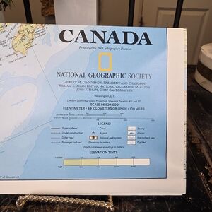
This is a genuine, large-scale, fold-out map of Canada produced by the Cartographic Division of the National Geographic Society. These maps are renowned for their accurate detail, excellent color separation, and high quality. Based on the editors and officers listed (Gilbert M. Grosvenor, William L. Allen), this map was likely published in the 1970s (a fantastic piece of Canadian history!).
This map is perfect for cartography enthusiasts, as a unique piece of Canadian wall decor, or for use in craft projects and decoupage.
Key Details:
Subject: Canada (The North Atlantic, Maritime Provinces, and a portion of the Northeastern US are visible in the image).
Publisher: National Geographic Society
Date: Circa 1970s (Based on leadership listed on the map).
Scale: Clearly printed as 1 Centimeter = 69 Kilometers (or 1 inch = 109 miles).
Format: Folded map (original dimensions when unfolded are typical of NG magazine supplements, generally around 27" x 40").
Condition: Good Vintage Condition. The map is currently folded (as issued) and appears to be clean with vibrant colors. As a vintage folded map, minor wear along the crease lines is to be expected once unfolded, but it is ready for framing or display.
Vintage Map, National Geographic, Canada Map, Wall Decor, Cartography, Travel Decor, Folded Map, 1970s, Canadian History, Vintage Wall Art, Geography.
Shipping/Discount
Posh Protect: Buyer Protection Policy
Get your order as described or receive your money back. Learn More.

sophiamarie506
likes this


Find Similar Listings
About the seller

@ispycollectible
Last Active: 3 hours ago
Toronto, ON
3817
Listings1400+
Sold Listings2 days
Avg. Ship time100+
Love NotesAbout the seller
@ispycollectible
Last Active: 3 hours ago
Toronto, ON
3817
Listings1400+
Sold Listings2 days
Avg. Ship time100+
Love Notes
Account is under Review
Comment posting is temporarily restricted. Our team will reach out to you shortly. To understand why, select
Learn More.
